
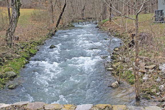

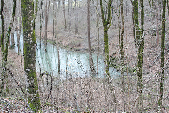


Nestled in the valley between the Cumberland Plateau and Brady Mountain lies the Head of the Sequatchie River. There, a blue-green pool of water spills out of the Plateau’s limestone walls and flows 116 miles to the Tennessee River.
Some of the first settlers to Cumberland County found this paradise in the 1790s. The property was first settled by Adam Sherrill, a veteran of the Revolutionary War, according to the Tennessee Parks and Greenway Foundation, which led the effort to preserve the site in 2008. His son, Craven Sherrill, served as the first sheriff of Cumberland County, with the family burial site maintained by The Crab-Ochard Chapter of the National Society Daughters of the American Revolution.
Led by Capt. Jim Lowe, a 1905 Crossville Chronicle article retells the journey of a group of settlers to the Cumberland Plateau and the natural treasures they encountered. But Devilstep Hollow Cave shows native tribes knew of this sacred place long before the westward migration of American pioneers.
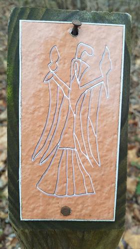
The cave is the only one in the southeastern United States that includes three historic forms of cave drawings: mud glyphs, petroglyphs and pictographs. It is believed the drawings date back to 1280 or 1300 A.D.
The drawings include a falcon or warrior image cut into the cave wall. It’s similar to the trail markings you can find on the 1-mile loop trail to the cave opening. Archeologists have said the image is a mythical figure in indigenous cultures with “god-like” status.
Another picture shows a man transformed into an ax while a charcoal drawing of a dog or wolf is visible.
It’s closed to visitors both to protect the archeology and the ecology of the area. In fact, all caves on state-owned lands are closed to the public to fight white-nose syndrome, a disease killing bats across North America.
Water from the cave comes from Grassy Cove, about 9 miles away but separated from the valley by Brady Mountain. Grassy Cove is another unique geological site that has been designated a National Natural Landmark. The cove is surrounded by Black Mountain to the north, Brady Mountain to the west and Bear Den Mountain to the east. Brady and Bear Den mountains meet to enclose the valley. It depends on underground streams to carry water away from the farmland and homes, with Grassy Cove Creek dropping into Mill Cave.
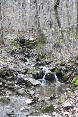
For years, residents of the area believed the water leaving through Mill Cave was traveling under the mountain and exiting at Devilstep Hollow Cave to form the Sequatchie River, but the legend had never been tested.
In 1962, engineers from the U.S. Geological Service and Tennessee Valley Authority poured dye and colored chips into Mill Cave. Then they went back to Devilstep Hollow Cave and waited.
They thought it would take the water about 24 hours to make the journey under Brady Mountain. They waited for six days before the dye and chips emerged.
Today, this 385-acred site is preserved — part of the Tennessee State Park system and a stop on the Cumberland Trail currently under construction. It’s open once a month for visitors to hike the short loop trail and explore the history of the community and some of the first families of Cumberland and Bledsoe counties.
There are picnic facilities at the park and the remains of the Cave Springs schoolhouse are also on the grounds. The site overflows with wildflowers, native plants and birds.
In the future, the site will tie in with the Cumberland Trail, Tennessee’s first linear park connecting Cumberland Gap to the Tennessee River gorge with a 282-mile trail currently under construction.
Head of the Sequatchie is open 8 a.m. to 4:30 p.m. on scheduled days — the next day is March 16. Follow the park on Facebook for updates, special events and changes to the scheduled open days.
There will be a spring hike at Stinging Fork Falls State Natural Area March 23, beginning at 9 a.m. EDT, for hikers looking for another adventure along the Cumberland Trail and the annual Cumberland Trail Spring Festival is set April 6, 10 a.m.-3 p.m. EDT, at Ivy Academy in Soddy Daisy. Learn more about the status of the trail and open trail segments you can enjoy now and enjoy booths and activities such as a scavenger hunt, invasive plant basket weaving, craft and food vendors, and live music.
Getting There
GPS and cellphone signals are unreliable and spotty in the area. Use these directions to make your way to the park site.
From Crossville: take Hwy. 127 south; just after Basses Creek bridge, turn left onto Brown Rd.; in .7 miles, turn left onto Rhea Rd.; follow Rhea Rd. to Old Hwy. 28; turn right and follow Old Hwy. 28 until you reach Glyph Pkwy; turn left into the driveway; park in the grassy area.
From Pikeville: Take Hwy. 127 north and turn onto Old State Hwy. 28; turn right onto Glyph Pkwy.
2019 Open Dates
March 16
April 20
May 18
June 15
July 20
Aug. 17
Sept. 21
Oct. 19
Nov. 29
Dec. 21
Follow them on Facebook for updates and special events throughout the year.


Commented
Sorry, there are no recent results for popular commented articles.