


Projects
HealthMap Collaborations
LifeBuoy
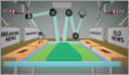
 HealthMap is collaborating with Unilever's Lifebuoy to improve consumer education around disease risk at the local level and encourage proper prevention practices in the home.
ProMED
 Under a recent grant from Google.org, ProMED is working to enlarge networks in Francophone Africa (ProMED-FRA) posted in French, and East Africa (ProMED-EAFR) posted in English, as well as to improve the multilingual capacity of PRO/MBDS. ProMED has partnered with HealthMap on this project, and the collaboration has already resulted in some exciting new visualization tools. New technologies include our shared interactive map, which plots ProMED disease reports onto the HealthMap site, and a more user-friendly design for the youngest ProMED regional network, ProMED-EAFR based in East Africa.
HealthMap Vaccine Finder
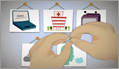
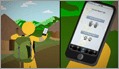
![]() HealthMap Vaccine Finder is a free, online service where users can search for locations offering flu vaccines. We work with partners such as clinics, pharmacies, and health departments to provide accurate and up-to-date information about receiving the flu vaccine. Our goal is to make flu vaccination available to everyone by simplifying the process of choosing and finding a vaccine provider.
HealthMap Vaccine Finder is a free, online service where users can search for locations offering flu vaccines. We work with partners such as clinics, pharmacies, and health departments to provide accurate and up-to-date information about receiving the flu vaccine. Our goal is to make flu vaccination available to everyone by simplifying the process of choosing and finding a vaccine provider.
In 2012, Google passed the baton to HealthMap when they retired Google's Flu Vaccine Finder. Google has worked closely with HealthMap as they've created the new HealthMap Vaccine Finder.
HealthMap Vaccine Finder was created in partnership with vaccines.gov, flu.gov and HHS.
Distribute
 A project of the International Society for Disease Surveillance (www.syndromic.org), the goal of the Distribute Project (http://isdsdistribute.org/index.php) is to enhance and support Emergency Department (ED) surveillance in order to make aggregate level data available to experts in public health. Distribute complements existing surveillance methods by providing a more comprehensive and detailed situational awareness of geographic and age-specific patterns of influenza-like illness.
GeoSentinel

 GeoSentinel is a network of travel/tropical medicine clinics initiated in 1995 by the International Society of Travel Medicine (ISTM) and the Centers for Disease Control (CDC). They work to maintain an international communications and data collection network of travel medicine clinics worldwide, to track geographic and temporal trends in infectious diseases among travelers, immigrants, and refugees, and to identify yet to be described emerging infectious diseases among international travelers. HealthMap created a website to show GeoSentinel’s worldwide disease alerts, and have added a GeoSentinel feed of respiratory alerts to our main page.
NEJM HealthMap
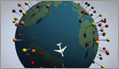
 HealthMap collaborated on an exciting project with the New England Journal of Medicine’s H1N1 Influenza Center (http://h1n1.nejm.org/) in response to the H1N1 outbreak. HealthMap developed an interactive map of worldwide cases of H1N1 influenza A (http://healthmap.org/nejm).
As reported in Science Magazine, HealthMap provided one of the earliest sources of information on H1N1: http://blogs.sciencemag.org/scienceinsider/special/swine-flu-timeline.html
1 April 2009 HealthMap, a global disease alert system run by academics, flags a news story from Mexico about a strange respiratory outbreak in the state of Veracruz that has claimed two lives.
HealthMap Haiti (collaboration with Ushahidi)
 HealthMap began monitoring focused news feeds in seven languages to obtain breaking information, regarding public health related events in Haiti on January 14th (http://www.healthmap.org/haiti). HealthMap continues to provide health alerts and other vital public health news regarding this natural disaster as it becomes available. As part of this effort, HealthMap is working with Ushahidi (http://haiti.ushahidi.com/reports/submit). The software behind Ushahidi allows text messages to be mapped by time and location. It was initially developed to track reports of ethnic violence in Kenya in 2008.
Wildlife Conservation Society
 The Wildlife Conservation Society (WCS) works to save wildlife and wild places worldwide through science, global conservation, education, and the management of the world’s largest system of urban wildlife parks. As part of the USAID Avian and Pandemic Influenza and Zoonotic Disease Program’s PREDICT “One Health” team, the WCS monitors wildlife diseases worldwide and maintains the GAINS database, which was designed to identify the movements of wild avian species for influenza and other viruses. HealthMap, as part of the PREDICT project is working with the WCS to expand and improve upon the global wildlife disease surveillance information included within the GAINS database.
Global Public Health Intelligence Network (GPHIN)
 GPHIN is a secure, Internet-based "early warning" system that gathers preliminary reports of public health significance in seven languages on a real-time, 24/7 basis. HealthMap provides the Global Public Health Intelligence Network (GPHIN) with an internal, interactive map of the system’s worldwide alerts.
NaTHNaC (Health Protection Agency)
 The National Travel Health Network and Centre (NaTHNaC) promotes standards in travel medicine, providing travel health information for health professionals and the public. HealthMap provides NaTHNaC with global infectious disease alerts that are then used to aid in improving the quality of travel health advice available to GP practices and other health care providers throughout the United Kingdom.
Humanity Road
 Humanity Road is a global nonprofit organization of volunteers working to collect collaborate and communicate information during a disaster and specialize in emerging events. We educate the public before, during and after a disaster on disaster preparedness and recovery actions. In 2010, Humanity Road partnered with aid agencies to assist in a special project auditing and updating the Haiti hospital resource finder online application for MSPP and PAHO. The organization also led a collaboration effort with Crisis Mappers and Healthmap at the onset of the cholera outbreak.
International Network of Crisis Mappers
 Crisis Mappers Net is a community of individuals interested in leveraging mobile platforms, computational linguistics, geospatial technologies, and visual analytics to power effective early warning for rapid response to complex humanitarian emergencies. As the world's premier crisis mapping hub, CM*Net catalyzes communication and collaboration between and among crisis mappers with the purpose of advancing the study and application of crisis mapping worldwide.
NPR - National Public Radio
 NPR creates and distributes award-winning news, information, and music programming to a network of 900 independent stations. The mission of NPR is to work in partnership with member stations to create a more informed public - one challenged and invigorated by a deeper understanding and appreciation of events, ideas and cultures.
In partnership with Boston’s NPR, WBUR 99.9 (http://www.wbur.org), and Seattle’s NPR, KPLU 88.5 (http://www.kplu.org), HealthMap has created real-time views of health alerts to be displayed on the respective station Websites. (http://commonhealth.wbur.org/healthmap and http://humanosphere.kplu.org/healthmap)
PathoSystems Resource Integration Center (PATRIC)
 HealthMap is now collaborating with the PathoSystems Resource Integration Center (PATRIC). The goal of PATRIC is to develop bioinformatics resources for the research and countermeasures-development communities based on genomics data. This is part of the biomedical research community’s work to integrate vital information on pathogens, to provide key resources and tools to scientists, and to help researchers to analyze genomic, proteomic and other data arising from infectious disease research. PATRIC provides rich data and analysis tools for all bacterial species in the selected NIAID category A-C priority pathogens list.
As part of this new collaboration, HealthMap has created a visualization for each bacterial pathogen in PATRIC that is associated with an infectious disease. These maps are available through PATRIC’s Disease Overview pages to provide geospatial context to bacterial infectious disease data.
By Clark Freifeld and John Brownstein. Copyright ©2007.
This site necessarily relies on publicly available third-party information.
We assume no responsibility for its accuracy or completeness.
Terms of Use